Rainy Day Decisions #12 & 35

I write to you, family, friends, and readers from around, from Canmore, Alberta. The grand, seventy-nine-day road trip has come to an end. Here is the last post about my adventures with Tom in the  United States, as I will return to blogging about recipes after this:

Glacier National Park, Montana, was our last stop: the only national park shared between Canada and the United States. Our plan was to spend a few days in the US part, then a few days in Waterton, Canada. This plan was adjusted after we were faced with the following three obstacles: forest fire smoke that clouded some of the hikes and views on the east side of the park, a lack of free camping, and a rainy forecast later in the week.

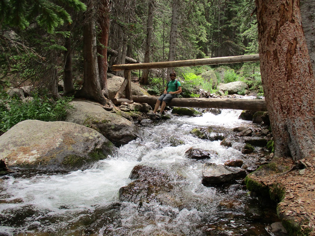
Glacier is a very large park. The first two days we spent on the West Glacier side. We discovered a picnic area beside a lake that was very quiet, and went there twice to prepare food. We also hiked over 10 miles along the Highline Trail, not realizing that our decision to hike it backwards meant that we were going uphill rather than downhill. We were exhausted by the end, especially because it was so hot that day. However, the views were gorgeous, and we saw some wildlife, which both made the hike exciting.

IMG_1137

Deer having his lunch right before we had ours

IMG_1140

View from the Highline Trail

IMG_1148

Marmot

IMG_1151

Bighorn Sheep

Our transition to the other side of the park is where we encountered some difficulty. We thought we would take a leisurely drive through the park to see what was in the middle, but encountered a lot of traffic, and then drove through the smokiest area of the park. We discovered on the east side that outside the park was a Native American reserve, which meant that we could not camp in any of the forest area. We had to drive about an hour south of the Many Glacier entrance of the park to find a forest service road with primitive camping on the side of a dirt road. Our commute to the Many Glacier entrance involved driving through more smokiness, and  loose herds of cows that liked to jump out unexpectedly on the long, windy road. There were only so many days we wanted to deal with this.

We hiked to Iceberg Lake at Many Glacier, which was one of my favourite hikes of the trip. It was 10 miles long from start to finish, but not very inclined, and the lake at the end was spectacular.

IMG_1164

Check out the icebergs in the lake

IMG_1176

A few times throughout our trip, we were able to escape bad weather by moving on to our next destination, but as we were at the end of the trip, so close to Tom’s home, and in an area with no free camping, we made the decision that Waterton could wait for another trip. It is, after all, only a few hours from Calgary, and we can go during a time when the weather is more appealing. It was a decision that I felt bittersweet about; I didn’t want to cut our trip short, but both of us were starting to make peace with it coming to an end.

IMG_1190IMG_1195

On our last day we went to the Two Medicine entrance and skipped rocks at Two Medicine Lake.

I think it is evident that this trip has been an incredible adventure. At the risk of sounding cheesy, I have learned a lot about myself and what I am capable of, as a climber and a person. I could not have asked for a better travel companion, and even with all the nicks and bruises along the way, it was all worth it. I am truly grateful for the people who have taken the time to read and comment on my posts over the last three months. Thanks for all the support!

After three months of living out of a car, eating one-pot meals, having limited access to showers and toilets, and sleeping in a real bed only once, it is back to reality I go. You can be sure that at the next possible moment, I will hop right back in my car-home and continue to explore this beautiful world.

Tits and Stones

Right after posting my last post, Tom and I were packing up to leave the Old Town Café, in Lander WY, when we ran into a couple we had met in Devils Tower: Meera and Kurtis. We grabbed a bite and some brews with them, and agreed to meet the next day to climb together at Wild Iris. After that day, both Tom and I were too sore to imagine another day climbing; pocket climbing at Wild Iris left me with cuts on my hands and cuticles, and almost no skin on my fingertips. We packed up our campsite and made our way to the Grand Tetons.

IMG_1060

Tetons after the rain – view from our campsite

That day was rainy, and it seemed as if out of nowhere we could see high peaks looming among the clouds. The view of the sharp, majestic Teton peaks followed us along the highway, getting more and more incredible. The view followed us to the free campsite we found, where we had a full frontal view of Les Trois Tetons (“the three breasts”: Grand, Middle, and South). The first night we were there, the Grand was hidden by clouds, and it wasn’t until the following evening that we were able to see the tip of the Grand in all its glory.

IMG_1043

Tetons hidden in the clouds

During our two-day stay, we hiked the approach trail up to the base of the Grand Teton, where climbers go to camp out before summiting the Grand the following day. Tom and I considered doing some climbing, but the weather forecast was poor, and we don’t have the right equipment for backpacking. We also hiked around Jenny Lake, and up to a view called Inspiration Point. We explored Jackson, and enjoyed beers and nachos during happy hour at Snake River Brewery (“put our river through your liver”, as their motto says). Two little highlights for me were seeing a herd of bison on the way to our campsite, and a black bear during one of our hikes.

IMG_1076

On the trail to see the Grand

IMG_1082

The Middle Teton

IMG_1085

IMG_1108

When we could finally see The Grand

IMG_1114

On our hike around Jenny Lake

The Tetons were touristy, but not nearly as much as our next stop, Yellowstone National Park. We drove through the south entrance and to the west entrance in a day, stopping to see the geysers and mud pots along the way, reminiscent of the active volcano Yellowstone once was. We saw Old Faithful geyser, which spurted up a stream of 4000-8000 gallons of water into the air, right on its natural 90-minute schedule, in front of the hundreds of tourist spectators, including us. We were both exhausted by the amount of people, and escaped to solitude at a dispersed camping area we found 15 miles outside the tourist trap that is West Yellowstone.

IMG_1127

Sunset Pool

IMG_1131

View of the geysers

IMG_1133

Little cloud in the mountains and the river beside our campsite

Going west into Yellowstone National Park brought us into Montana, leading us closer to our next stop: Glacier National Park. As we work our way north, Tom and I are facing the reality that our three-month road trip is coming to an end. One more week and we are back home.

Back to Colorado: Front Range Part Two and American Rockies

It’s hard to believe that it has been two months today since we left for our trip. Time seems to be going by faster and faster, and the more I am on the road, the more I want to stay on the road. Don’t get me wrong, there are some days when living out of a car gets frustrating: not having a fridge, having to shift around all of our belongings to sleep in the car, then having to shift it all back the next morning, having to do dishes with cold water out of a water bottle, or misplacing an item only to find it underneath all the climbing gear… Sometimes I miss the luxuries of living in an apartment or house, but at the same time there’s a lot to love: finding the new area and campsite, planning the next day’s adventures, and having the freedom to go anywhere and do anything. I appreciate everything about this trip, and the whole thing is precious, even the frustrations.

The last week has been spent in Colorado. We stayed a few nights at a friend’s cabin; Magoon (Megan, from the last Colorado post) kindly let us stay at her place while she was on a backpacking trip. During our stay we climbed Bastille Crack (5.7 trad multi-pitch) at Eldorado Canyon, simu-climbed the second Flat Iron (5.0 – I placed the gear for it, which ended up being every 30 feet or so), and sport climbed at Clear Creek Canyon with Anthony. We also tried out a pizza restaurant in Denver, called Hops & Pie; it was delicious and lived up to its reputation. On our last night at the cabin, Magoon’s housemate stopped by and had a few friends over for a BBQ. Unexpected things like this end up being the most memorable. Kyle was very generous and entertaining, to say the least.

IMG_0850  IMG_0859 IMG_0857Hidden in this photo is me leading the second Flat Iron

IMG_0872IMG_0864

These are from Clear Creek Canyon. Find me hidden in the wall on the first picture.

The next stop was Fort Collins, where we camped in Poudre Canyon – pronounced POO-der. Tom made fun of me for how frustrated I was with the butchering of the beautiful French word for powder. We didn’t climb in Poudre, but rather switched it up a bit and went to a movie: Mad Max, which we both enjoyed.

The next stop was Rocky Mountain National Park (RMNP). I was curious how the Rockies here compared to the ones in Canada, and I’ll admit my bias, but Banff and Canmore are way more beautiful. The mountains here are huge, but not as majestic as in Canada, at least what I saw from the Estes Park side. Tom and I climbed a few cracks at Lumpy Ridge, and hiked Mills Lake trail inside RMNP. It is truly beautiful here, but some of the beauty is taken away by the thousands of tourists. Tom and I almost ran the first 2 miles of the trail to sneak past the many hikers. It was nice to finally hike alone after Mills Lake, but I was struck by how so many people turned around before the hike got spectacular. The streams, waterfalls, lakes, and mountainous backdrops were breathtaking, especially Black Lake. Today we plan on hopping on a 5.8 trad multi-pitch called White Whale, then we will make our way back to Wyoming. RMNP is way too busy for our liking, and it feels weird to be frustrated at tourists, when we are tourists ourselves.

IMG_0876 IMG_0901

These are from our day at Lumpy Ridge.

IMG_0906 IMG_0932

This lake is Mills Lake

IMG_0922

Living up to its name: Black Lake

Thanks for reading! Much love sent back home to Ottawa, and to friends and family all around. ❤